
More languages
More actions
No higher resolution available.
Map_of_the_Strait_of_Hormuz_and_pipelines.png (586 × 385 pixels, file size: 53 KB, MIME type: image/png)
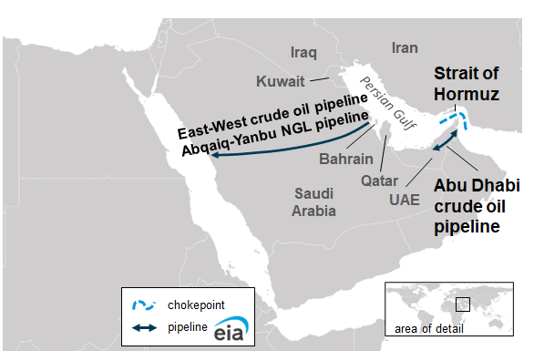
A map using information from the U.S. Energy Information Administration showing the Strait of Hormuz and crude oil and natural gas liquids pipelines in the region.
Source: https://www.eia.gov/international/analysis/special-topics/World_Oil_Transit_Chokepoints
File history
Click on a date/time to view the file as it appeared at that time.
| Date/Time | Thumbnail | Dimensions | User | Comment | |
|---|---|---|---|---|---|
| current | 20:04, 20 May 2026 | | 586 × 385 (53 KB) | Verda.Majo (talk | contribs) |
You cannot overwrite this file.
File usage
The following page uses this file:
