
More languages
More actions
Subcategories
This category has the following 6 subcategories, out of 6 total.
B
- Balkanization maps (3 F)
H
- Historical maps (1 F)
L
- Locator maps (1 F)
M
- Maps of UN votes (9 F)
T
- Thematic maps (2 F)
- Time zone maps (1 F)
Media in category "Maps"
The following 37 files are in this category, out of 37 total.
-

-
 A map of the Imperial Powers of the Pacific, 1939-09-01.png 1,280 × 1,003; 357 KB
-

-
 Angola map.png 2,048 × 2,048; 688 KB
-
 British-mandate-palestine-1947.jpg 699 × 1,537; 53 KB
-
 Colonial and imperial spheres of influence in Asia.jpg 732 × 889; 852 KB
-
 Colonization of Palestine.png 1,341 × 918; 940 KB
-
 Cultures of North America circa 1500.png 800 × 897; 528 KB
-
 Diego Garcia in the Indian Ocean with distances to other locations.png 850 × 715; 174 KB
-
 Global Trade Balance of Raw Sugar in 2024.png 712 × 622; 152 KB
-
 Great Britain and Russian Empire Compete for Influence in Central Asia.jpg 1,200 × 960; 111 KB
-
 Japanese Empire Building 1870-1942.png 639 × 798; 519 KB
-
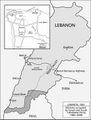 Lebanon-1982.jpg 1,104 × 1,459; 87 KB
-
 Map detail of southern Africa with independence dates.png 468 × 474; 23 KB
-
 Map of ancient and medieval sub-Saharan African states.jpg 1,172 × 1,197; 785 KB
-
 Map of military activity in Zimbabwe circa 1974-1979.png 827 × 686; 627 KB
-
 Map of Portuguese colonial empire.jpg 2,000 × 1,124; 165 KB
-
 Map of the SCO.png 2,836 × 1,440; 427 KB
-
 Map of the Strait of Hormuz and pipelines.png 586 × 385; 53 KB
-

-
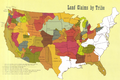 Native land claims map.png 1,278 × 854; 1.81 MB
-
 One-belt-one-road.svg.png 1,920 × 1,290; 445 KB
-
 Operation barbarossa 06-10 1941.png 1,500 × 2,146; 4.13 MB
-
 Prehistoric archeological sites map of Korea.jpg 1,818 × 2,015; 941 KB
-
 Provinces of Korea.png 555 × 900; 130 KB
-
 Routes of the United Fruit Company's Great White Fleet.jpg 1,182 × 784; 283 KB
-
 Southeast Culture Area of North America circa 1500.png 800 × 887; 545 KB
-
 Soviet But Not Russian, p 120, Close-up map of Central Asia.png 867 × 663; 727 KB
-
 Soviet But Not Russian, pp 2-3, USSR map.png 1,394 × 940; 1.56 MB
-
 Syria proposed pipelines.jpg 640 × 420; 100 KB
-
 Timezones2008 UTC-6 gray.png 3,583 × 1,917; 969 KB
-
 U.S. Indo-Pacific Command AOR and Selected Bases.png 1,540 × 786; 367 KB
-
 U.S. Military Installations in Guam.png 600 × 900; 143 KB
-
 USA settler expansion.png 500 × 250; 858 KB
-
 World 1914 empires colonies territory.png 1,522 × 628; 45 KB
-
 Xinjiang map.svg 857 × 699; 139 KB
-
 Xinjiang.webp 700 × 348; 84 KB


